Basics

Thematic maps allow dynamic changes to be made to the display of geographical maps without the display changing the base map.
This can be used for custom map display, statistical analysis and visual navigation.
MapInfo - Tab - Files
Geographical data in the sense of ConnectMaster are TAB files of the manufacturer Pitney Bowes MapInfo.
The viewer "MapXtreme 7.1" is integrated in ConnectMaster.
However, the main product "MapInfo Professional" is also used in the course of these instructions.
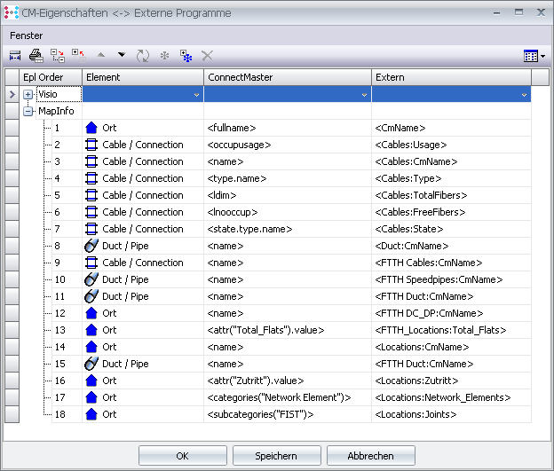
Data transfer
For some representations it is necessary to transfer data from ConnectMaster into the layer files. This is done via settings in the library:
Menu -> File -> Library -> Mapinfo -> Settings -> Button "
CM Properties <-> External Programs" -> Mapinfo