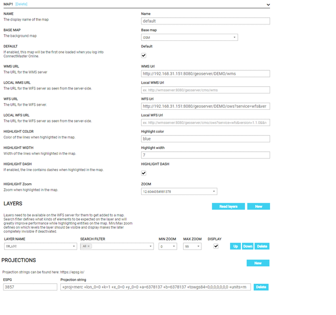
Adding MAPS

To add a new map the following section of form should be filled.
-Map:
-Name displayed of the map
-Base Map
-Default: enable the map loading first
-WMS URL for WMS server
-LOCAL WMS URL
-WFS URL for WFS server
-Local WFS URL
-Highlight Color: Color of the lines when highlighted on the map
-Highlight Width: Width of the lines when highlighted on the map
-Highlight Dash: enable/disable dash of lines when highlighted on the map.
-Highlight Zoom: Show extent of highlighted objects.
The maximum zoom level used by default is 28 and the minimum zoom level is 1.6036263449861918.
The list of zoom values is represented in a dropdown list.
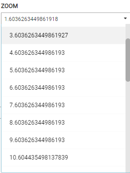
List of zoom values
To retrieve the list of values, we use the link https://codesandbox.io/s/9ztgu , then, we add the function onMoveEnd(evt) in the map.js file.
function onMoveEnd (evt) {
var mapView = map.getView ()
var zoom = mapView.getZoom ();
document.getElementById ("zoom"). innerHTML = zoom
}
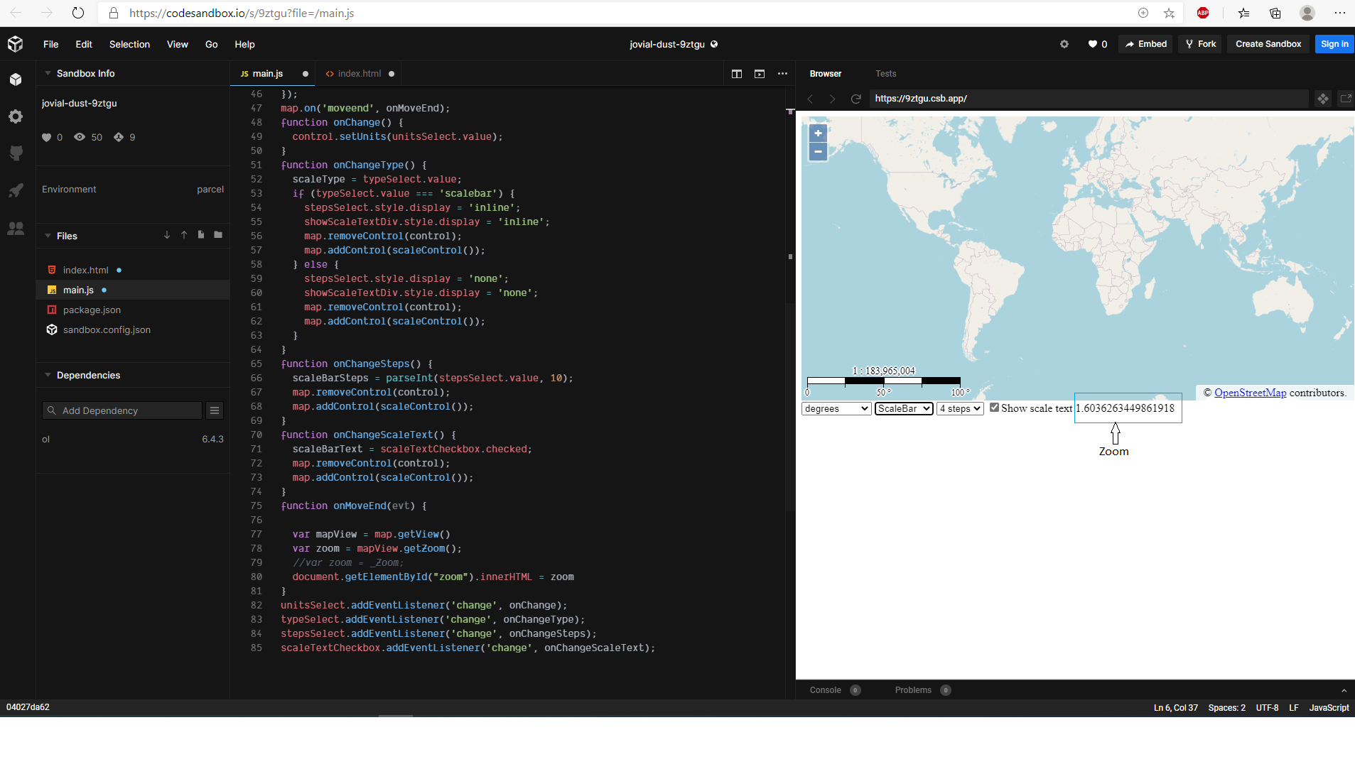
Example Scale line - Open Layers.
When we click on the bottom zoom out, the zoom value changes.
If we choose: highlight zoom = 8.603626344986193
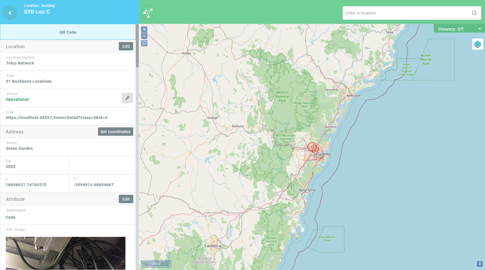
highlight zoom = 8.603626344986193– Example on selected location.
If highlight zoom = 12.604435498137839:
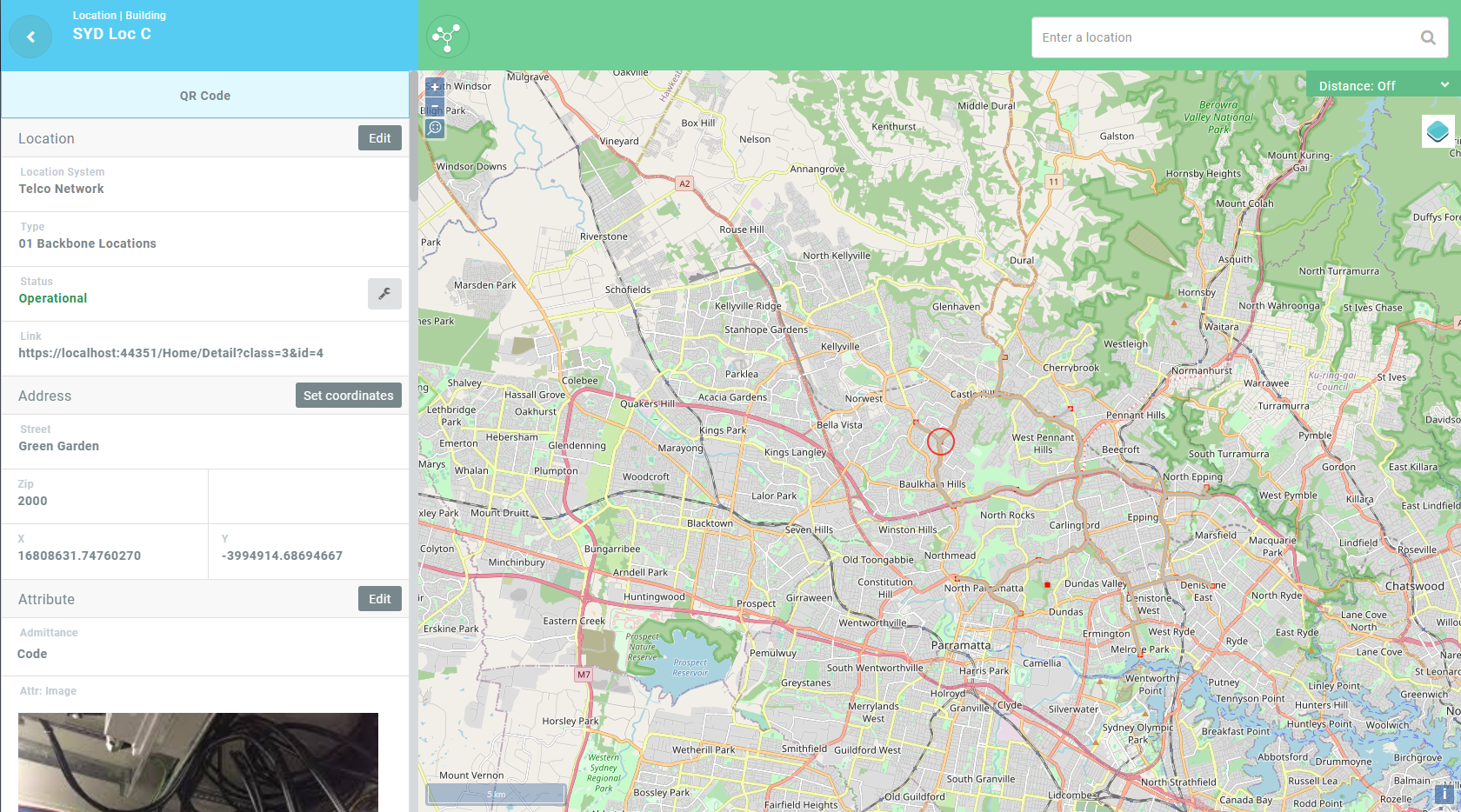
highlight zoom = 12.604435498137839– Example on selected location.
-Layers:
-Layer name
-Search filter
-Min zoom
-Max zoom
-Projections:
-EPSG
-Projection String can be found at “https://epsg.io”
configuration Manager Interface -Section Maps