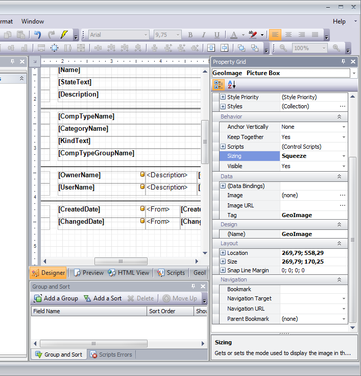
Xtra-Reports with GeoImage

To print a map in a report, an image must be inserted, which possesses the value „GeoImage“ in the property „Tag“. The property “Sizing” in the section behaviour should be changed to „Squeeze“.
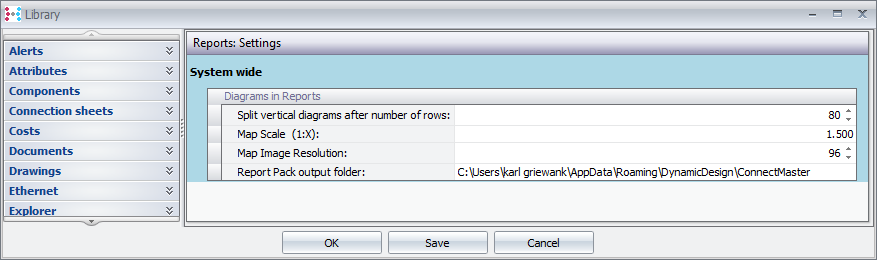
In the library the map scale as well as map image resolution in reports are set system wide.