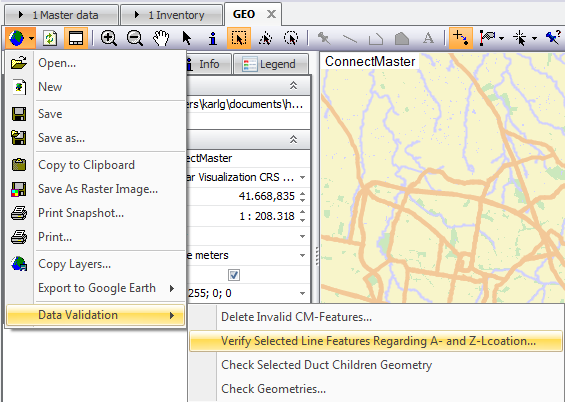
Examine A- and Z-Locations of the selected line objects

The end locations of the line on the map are determined and compared with the end locations of the cable/ducts in the data base. Beforehand it is examined if the line is continuous and if the line can even be assigned to a database object

A certain tolerance is allowed between the end of the lines and the location positions. This is defined using the search radius defined in the settings.
