Administer GEO Formats with a referenced coordinate system

Library |
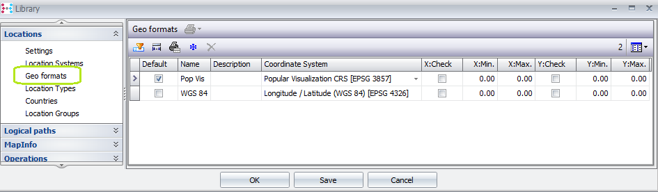
New presentation of GeoFormats in the Library: Under Locations à Geo formats
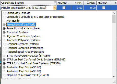
Fields: 1.Default: User can define multiple Geo formats, and assign a default geo format which will be applied by default when new locations are created. 2.Name: a user definable name for the Geo Format 3.Description: an optional description field 4.Coordinate System: a drop down list of available pre-defined coordinates as available in the integrated mapping interface.
5.X and Y Check, Min and Max fields: Define coordinate checks and ranges. Is applied if the system wide Library setting “Locations: Settings: Check coordinates on input:” is active Note: functionality is available whether or not the integrated mapping module is licensed. |
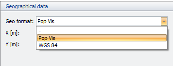
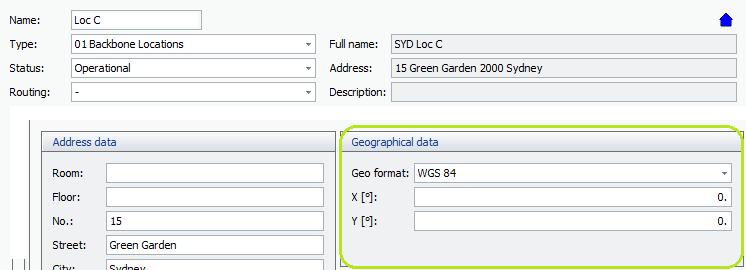
Set the geo format for a location |
In Location details, set the relevant geo format from the drop down field in the Geographical data section
NB: for newly created locations, the default Geo format will be automatically assigned and can be changed manually by the user.
|
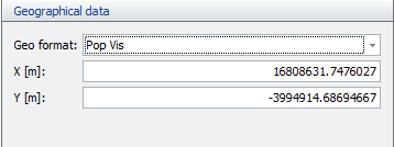
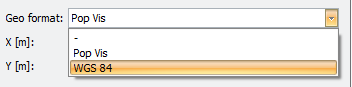
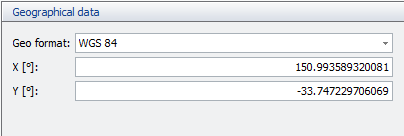
Change the geo format |
In Location details, when a geo format is set, the user can change the geo format via the drop down in the Geographical data section:
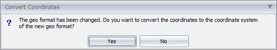
The below pop up message is displayed: Click Yes to convert the stored coordinates from the old geo format’s coordinate system to the new. Click No to set the new Geo format without conversion.
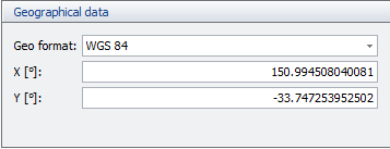
Example result with conversion:
|
Degrees / meters indication for coordinate values |
In Location details, as a function of the coordinate system definition for the selected geo format,
|
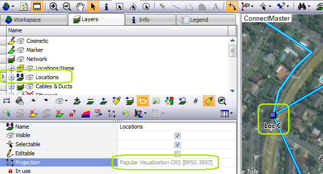
Auto convert between coordinate systems for actions between Map and database |
It is possible that the geo format and coordinates of a location in the database is based on a coordinate system that is different the workspace of the maps or from the layer, or both. ConnectMaster now proposes to update coordinates and automatically converts them between the relevant coordinate systems to store the coordinate to the database according to the geoformat of the defined location.
Example: for a location whose layer is popular visualisation and location in database is WGS84: Read coordinates from map for location:
After action in map: read coordinates of selected objects:
|