Geoserver

Attention: GEO Server works only with Oracle Locator, no Tab file support.
1.Install current Java JRE
2.Installation Geoserver
Guide: https://docs.geoserver.org/maintain/en/user/installation/win_installer.html
Notes: Install as service!
3.Install Oracle Extension for geoserver
Guide: https://docs.geoserver.org/maintain/en/user/data/database/oracle.html
Notes: Get Oracle ojdbc7 from https://www.oracle.com/technetwork/database/features/jdbc/jdbc-drivers-12c-download-1958347.html
4.Restart Service "Geo Server”
5.Navigate to http://localhost:8080/geoserver/ user:admin pwd: geoserver
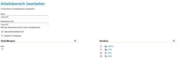
6.Add new "Arbeitsbereich", activate WMS and WFS
7.Add new "Datenspeicher"
Guide: https://docs.geoserver.org/maintain/en/user/data/database/oracle.html
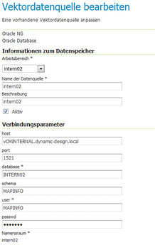
Additional settings: keep default
Important: Full Host (e.g. vCMINTERNAL.dynamic-design.local)
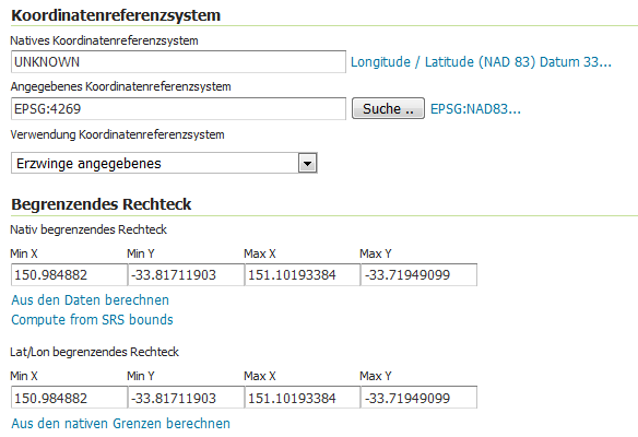
8.Create Layers
Set EPSG if not correctly indentified
Compute bounding box from SRS bounds
Compute Lat/Lon from native borders
 +
+
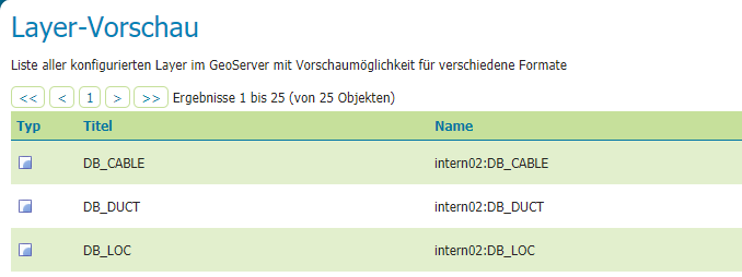
9.Check layer with “Layer-Vorschau” à OpenLayers